
This is a guest post from Andrea Meado, Image Data Scientist, and part of our Johnson Space Center (JSC) Image Detective Science Team
Astronaut Photograph ISS048-E-19445, 65mm lens, 07/03/2016. This astronaut photo is of Florida, USA looking towards the East. Credit: NASA
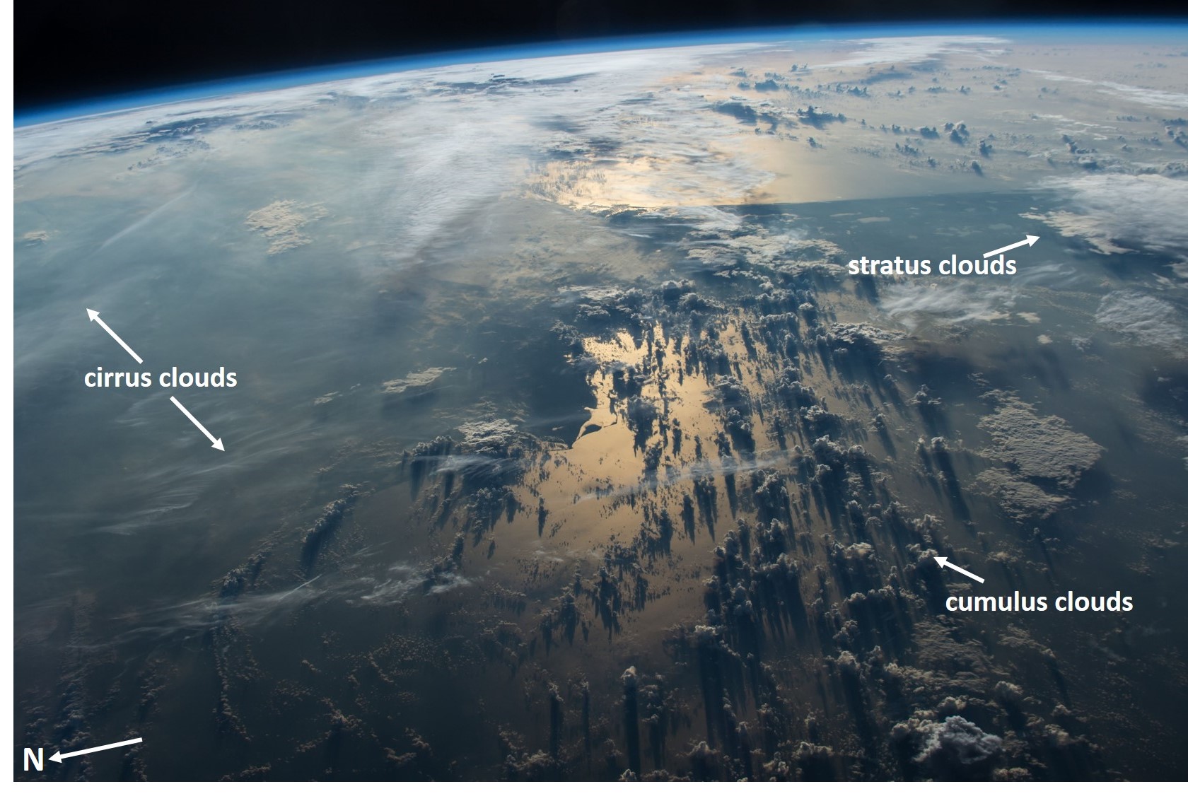
We observe clouds from the ground and lower atmosphere (aircraft) and experience weather conditions associated with them such as precipitation and temperature. Astronauts in space see clouds from a different, much higher perspective (approximately 400 km above Earth!) and their photos can offer a unique learning tool for students to interpret cloud dynamics. Astronaut photography of clouds can be used to identify different cloud types, visualize layers of Earth’s troposphere, and correlate weather patterns at local and global scales.
Common cloud types include cirrus, stratus, and cumulus. Imagery with multiple cloud types help students visualize what types of clouds exist in high or low levels of the troposphere.
Once cataloged using Cosmoquest’s Image Detective 2.0, a previously unidentified astronaut photograph has a specific date and geographic location associated with it. Students can use this data to look up the weather conditions on the ground when the image was taken. The student will have multiple types of scientific data (i.e. astronaut photo, date and location of photo, ground weather conditions) to form an understanding of the relationship between cloud types and weather. The use of astronaut photos of clouds can be applied to a specific area or a much broader scale overlooking Earth’s horizon.
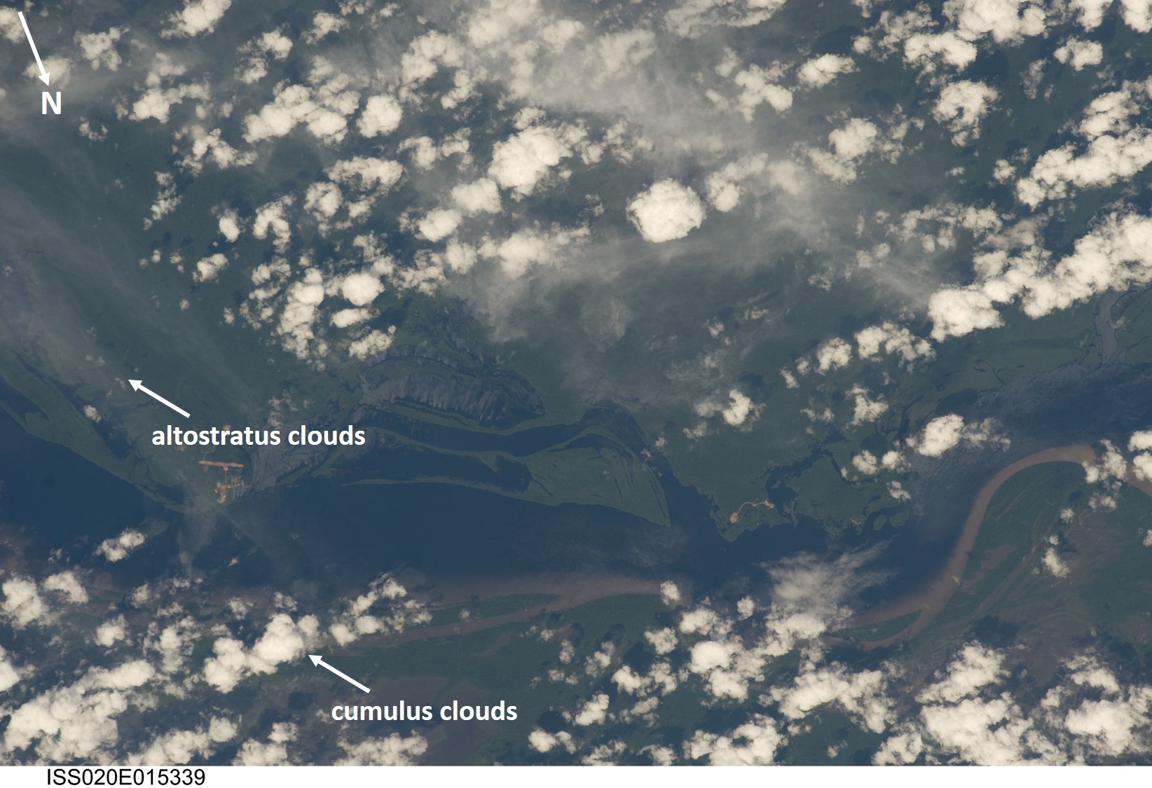
Astronaut Photograph ISS020-E-15339, 400mm lens, 06/27/2009. This astronaut photo is of Rio Negro in Brazil. Credit: NASA
NASA’s publicly accessible Astronaut Photography of Earth database, made available through the Gateway to Astronaut Photography of Earth website and curated by the Earth Science and Remote Sensing Unit at the Johnson Space Center houses over 2 million images taken by astronauts from space.
With CosmoQuest’s Image Detective 2.0 tool, Citizen Scientists around the world have the opportunity to enhance NASA’s Astronaut Photography of Earth database by identifying the center point location of astronaut photos. With center point locations, educators can quickly search and download the scientific data they need!
Go to CosmoQuest’s Image Detective 2.0 to identify the center point of astronaut photographs such as the images above, and advance scientific research by enhancing NASA’s Astronaut Photography of Earth database!

 Escape Velocity Space News
0 Comments