
Back in the spring of 1999, while one part of the internet focused in on still unpatched Y2K bugs, another, often overlapping part of the internet focused in on something much more fun – the search for extraterrestrial life. The BOINC project at U Cal Berkeley had released a new screensaver designed to use computers that would otherwise be sleeping to process radio astronomy data for the kinds of patterns that could indicate alien life.
I have to admit, my computer was deeply engaged in processing my dissertation data, so it didn’t get down time from it’s personal search for galaxy clusters, but the public computers at McDonald Observatory had SETI@Home installed and it was cool to watch the spiky noise flow across the screen. This was the first fully online crowdsourcing campaign I’ve been able to identify in space science. While human minds didn’t get utilized, this project has engaged 5.2 million participants, demonstrating that a lot of humans will contribute available resources to science if you just ask.
SETI@Home has spun off numerous other projects powered by the BOINC software, including EINSTIN@Home, which looks for pulsars in radio and gravitational wave data, and climatepredictio.net which runs climate models.
From utilizing unused computing resources, it wasn’t a big leap to ask people to volunteer their unused thinking resources.
Stardust@Home engages volunteer minds
In August of 2006, folks from U-Cal Berkeley once again asked the public to help them process data. This time, they had images of the aerogel flown by the StarDust mission. In this gel, tiny grains of interstellar dust were trapped and waiting to be found in images and retrieved by scientists. The thing was, there were too many images for the science team to search in a reasonable amount of time, so they created an online interface and a proficiency test and invited the public to come help them out.
I have to admit, I failed their proficiency test. I am no good at finding dust in images.
Back in 2006, I was a variable star astronomer, working with amateur observers on various projects, and serving on the AAVSO’s board of directors. Community science and podcasting were two major parts of my life. What I didn’t realize was the revolution that was about to take place as massive telescopic surveys began to flood researchers with data. In 2009, the launch of the Lunar Reconnaissance Orbiter led to the need for a way to get help from humans to map out lunar features. Along with Chris Lintott, I’d written the grants for the project that’d become Zooniverse, and we launched Moon Zoo on the heels of the LRO. In 2011, CosmoQuest was started with funding from LRO, MESSENGER, Dawn, and New Horizons, and over the years, we’ve helped numerous missions find the safe places to touch down and the scientifically interesting places to explore.
I’d like to say, it’s super weird to be part of news we’re reporting here, but I’m super proud of what we’ve accomplished and this is a story of our volunteers – I’m just the person behind the software.
Bennu Mappers: 14 million annotations in 92 days
Those volunteers are amazing. In the summer of 2019 we mapped the asteroid Bennu in 92 days.
In those 92 days, nearly 4000 people made over 14 million annotations of rocks, boulders, and craters on the asteroid Bennu. The site selection team used this data and data from the other teams to identify four potentially safe enough landing sites.
Join in the fun at mappers.psi.edu
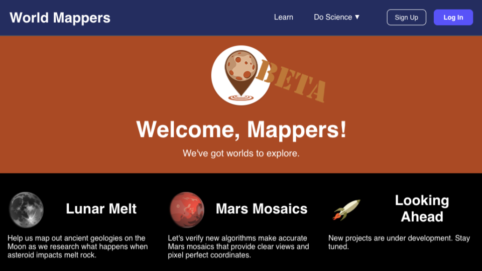
Starting in January of this year, I began work on an entirely new citizen science project, World Mappers. Designed to support NASA projects studying the Moon and Mars, I’m pleased to say I am back in the game of crowd-sourcing science, and all of you are invited to come along. We’re still in beta. I am the lone programmer. And I invite all of you to help me shape this project into a new way to explore the next two worlds humans are likely to visit. You can participate both as a mapper, and as a contributor to our open-source code base.
The first project, Mars Mosaics, asks for your help validating new mosaics of Mars images taken by the Mars Reconnaissance Orbiter’s Context Camera. Using today’s standard data processing techniques, researchers have to deal with mismatched images that make it hard to make out subtle features and identify changes on Mars surface as the seasons pass and new craters form. Research Stuart Robbins is heading up a project to redefine how images are mosaiced together, and for the most part he is getting amazing results, but every once in a while, the software just says, nope, I’m going to make this region of mars look like Picasso designed it. We need your help finding these mistakes and flagging them so the software can be told to try again, and maybe use more matching points on try 2.
The second project is called Lunar Melt and, as the name implies, has folks looking at Lunar Melt. Specifically, we’re looking at LRO NAC data of the region around Little Lowell crater where an impacting asteroid melted part of the lunar surface and that melt did super weird and awesome geological things, like create massive boulders and then carry them away in a flow of melted rock. I want to see lavs, but this is literally rock melt with the energy of an asteroid impact. We currently have available tools for marking rocks, measuring boulders, and identifying craters, and we’ll be adding in additional tools for melting faults, flows, and other large scale features in the weeks to come.
You can get involved over at mappers.psi.edu
Please join us; there are worlds to explore together.