
This is a guest post from Andrea Meado, Image Data Scientist, and part of our Johnson Space Center (JSC) Image Detective Science Team
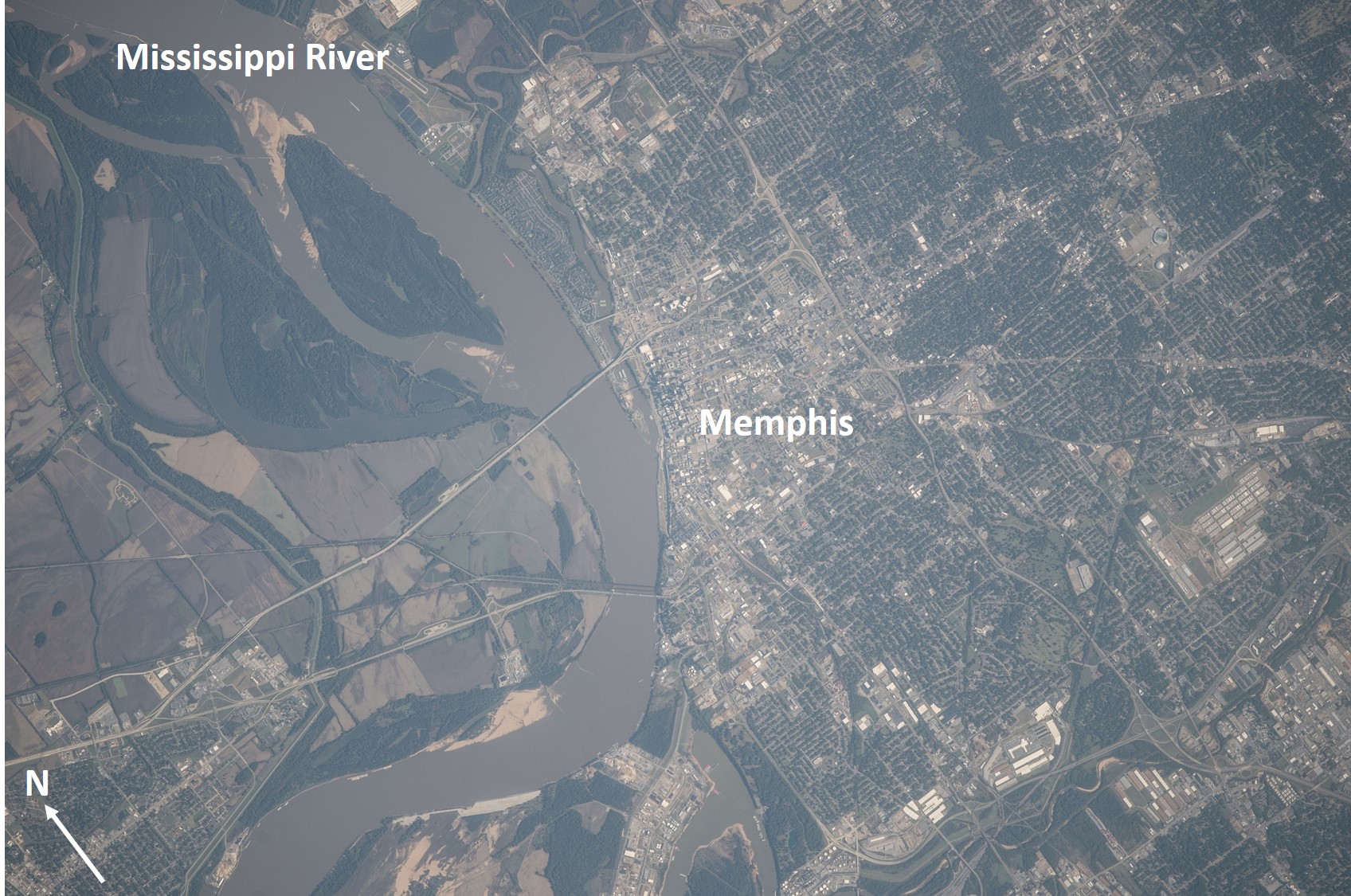
Astronaut Photograph ISS041-E-105521, 800mm lens, 10/30/2014. This astronaut photo is of the Mississippi River passing through Memphis, Tennessee. Credit: NASA
For thousands of years, settlements and populations have developed near sources of water. Having a reliable water supply or route is essential for basic human needs, agricultural demands, and transportation. Urban and agricultural developments that are dependent on water resources can be visualized using astronaut photography. The photo above shows a dynamic relationship between the Mississippi River, the city of Memphis, and surrounding farmland. Students can use scientific data such as astronaut photography to identify bodies of water and form ideas of why water resources are essential for population growth and agricultural development.
Astronaut photos of rivers, lakes, coastlines, and other bodies of water can show urban centers and farmland concentrated around these environments. The image below is of Lake St Clair, which falls along the US-Canadian border at Detroit, MI. East of the lake is abundant farmland that can be easily identified by rectangular plots of green and brown colored land in Ontario, Canada. West of the lake is the metropolitan area of Detroit and this area is distinguishable by its grey color and structured road systems. Educators can create activities using astronaut photos and challenge students to identify and understand the dynamic relationship between humans, the land, and local environmental resources.
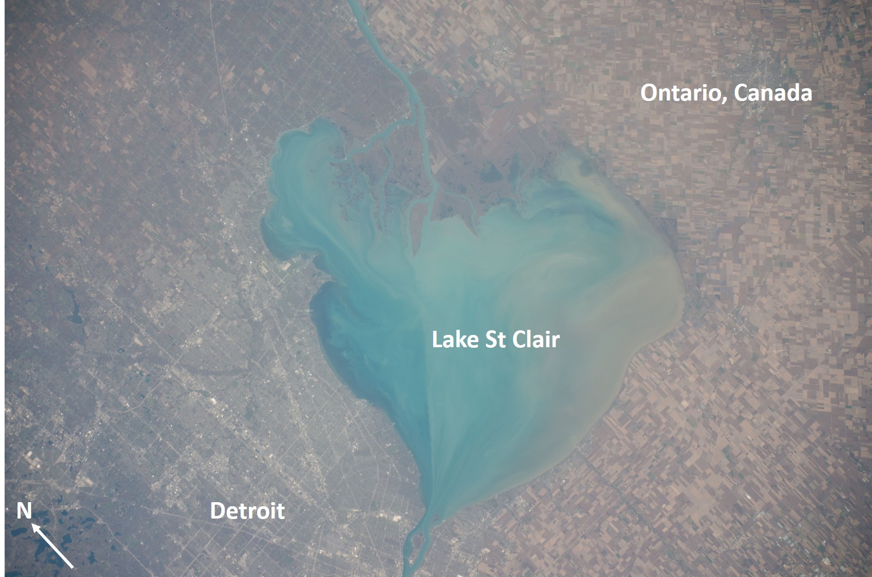
Astronaut Photograph ISS041-E-102345, 210mm lens, 10/26/2014. This astronaut photo shows Lake St Clair and the US-Canadian border. Credit: NASA
NASA’s publically accessible Astronaut Photography of Earth database is made available through the Gateway to Astronaut Photography of Earth website curated by the Earth Science and Remote Sensing Unit at the Johnson Space Center and houses over 2 million images taken by astronauts from space.
With CosmoQuest’s Image Detective 2.0 tool, Citizen Scientists around the world have the opportunity to enhance NASA’s Astronaut Photography of Earth database by identifying the center point location of astronaut photos. With center point locations, educators can quickly search and download the scientific data they need!
Go to CosmoQuest’s Image Detective 2.0 to identify the center point of astronaut photographs such as the images above, and advance scientific research by enhancing NASA’s Astronaut Photography of Earth database!

 Escape Velocity Space News
0 Comments