
This is a guest post from Amy Jagge, Image Data Scientist, and part of our Johnson Space Center (JSC) Image Detective Science Team
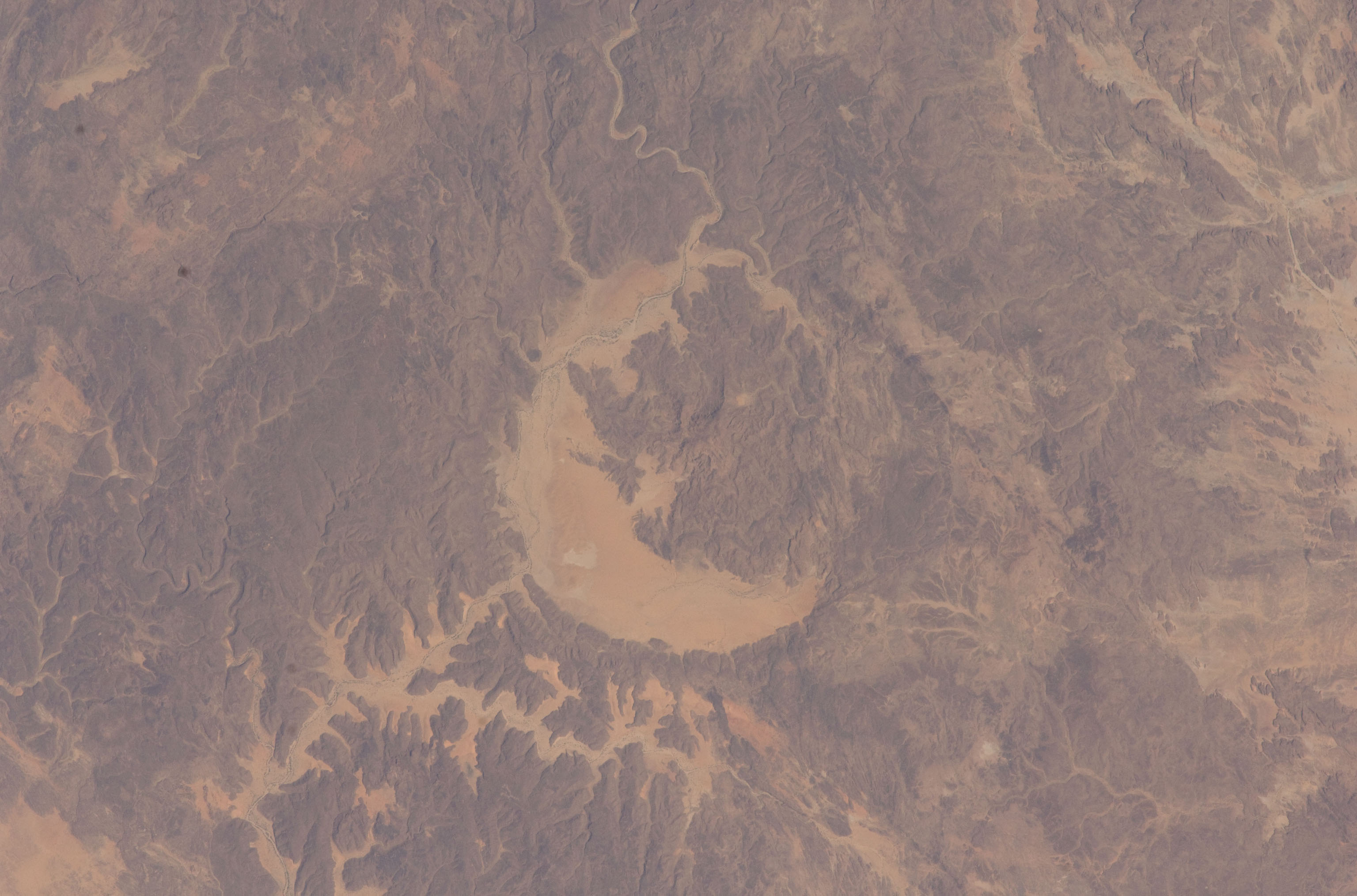
Astronaut photograph (ISS021-E-5375, 180mm, 10/12/2009) of impact crater Gweni Fada located in Chad. Impact craters observed on Earth provide an analog for scientists researching impact craters on Mars. Credit: NASA
Earth and Mars are commonly known for their differences. Earth is characterized by its habitable conditions and layered atmosphere while Mars is considered a dry, hostile planet with an almost non-existent, thin atmosphere. However, scientists investigating Mars (and other solar system bodies like the Moon) recognize the importance of researching their similarities as well as their differences to Earth.
Earth’s tectonic and erosional processes are constantly altering the surface of the planet. Distinct surface morphologies created by these processes can be observed with remotely sensed scientific data, such as astronaut photography and other Earth-observing sensors. These data provide planetary scientists the ability to study surface features on Earth as analogs to similar surface features visible on Mars and other solar system bodies.
As seen in the images below, the morphological characteristics of barchan dunes observed in the astronaut photograph are also visible in the Martian dunes seen by the Mars Reconnaissance Orbiter HiRISE imager. Scientific research on the formation of barchan dunes on Earth helps planetary scientists model the past and present environmental conditions that may have formed the same type of dunes on Mars.
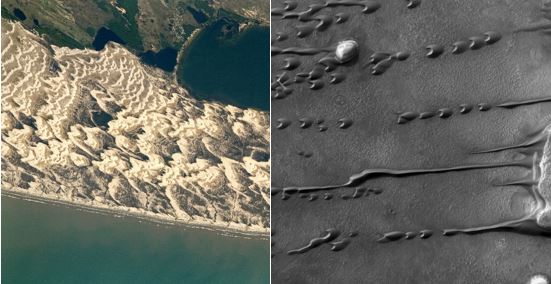
Left to Right: Astronaut photograph (Left: ISS052-E-14188, 1150mm, 07/09/2017), Mars Reconnaissance Orbiter HiRISE image (ESP_020018_1385, 11/03/2010).
NASA’s publically accessible Astronaut Photography of Earth database made available through the Gateway to Astronaut Photography of Earth website (eol.jsc.nasa.gov) is curated by the Earth Science and Remote Sensing Unit at the Johnson Space Center and houses over 2 million images taken by astronauts from space.Credit: NASA
With CosmoQuest’s Image Detective 2.0 tool, Citizen Scientists around the world have the opportunity to enhance NASA’s Astronaut Photography of Earth database by identifying the center point location of astronaut photos. With center point locations, planetary scientists can quickly search and download the scientific data they need!
Go to CosmoQuest’s Image Detective 2.0 to identify the center point of astronaut photographs such as the one below, and advance scientific research by enhancing NASA’s Astronaut Photography of Earth database!
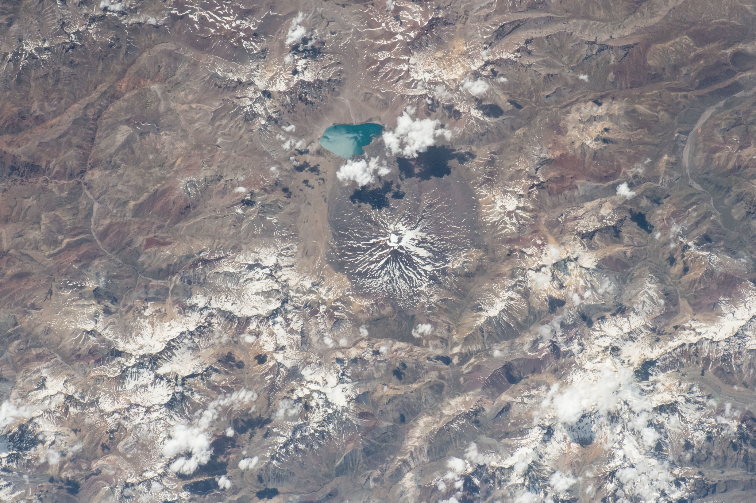
Astronaut photograph (ISS046-E-20213, 290mm, 01/23/2016) featuring a volcano with lava flow channels in southern Chile.Credit: NASA

 Escape Velocity Space News
0 Comments